
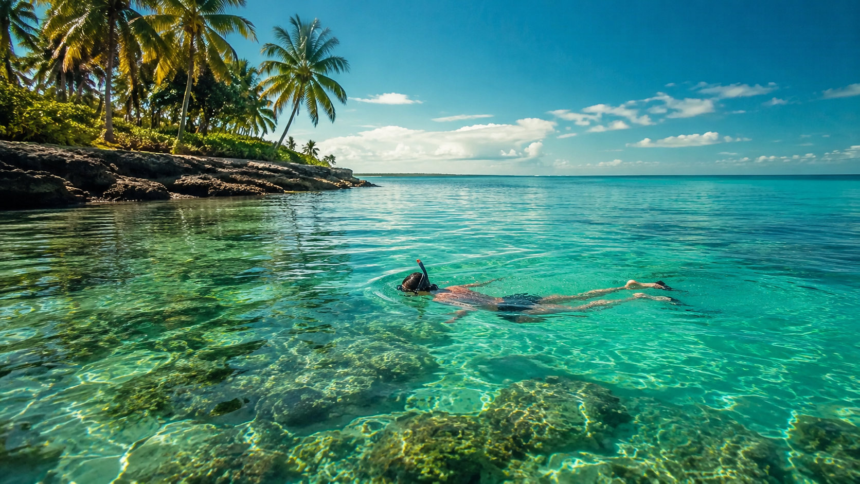
Why Bahamas Water Captivates Florida Travelers
Turquoise hues explained
The first time you fly over the Bahamas from South Florida, the color stops you cold. It’s that saturated, glassy turquoise—almost electric—spread across shallow banks. You’re seeing physics at work. Sunlight bounces off miles of white carbonate sand and crushed coral, then passes through clear, low-nutrient water that doesn’t scatter much light. Red and yellow wavelengths get absorbed. Blue and green punch through. The result is the vivid “Bahamas water” every Florida traveler dreams about.
Shallow sand flats do the heavy lifting. Over the Grand Bahama Bank and Little Bahama Bank you’ll find broad, shin-deep to boat-deep expanses that act like natural reflectors. Move from a bright sand flat to a grass bed or reef and the palette snaps from minty blue to cobalt in seconds. That fast flip—light over sand, dark over depth—is part of the thrill.
How it compares to the Florida Keys
Much of coastal Florida sees river runoff and stirred-up beach surf, especially after wind or swell. The Bahamas sit far from big river mouths, and the water column often stays remarkably free of silt. On a good day, clarity on Bahamian reefs rivals or beats top Keys sites off Key Largo and Islamorada. On a typical day, Bahamas water will be clearer than most mainland Florida beaches, closer to what you get on the outside reef line in the Upper Keys when the seas settle. Proximity to the Gulf Stream helps both places, delivering warm, clear Atlantic water that scrubs the reefs and keeps the color true.
Geography and Currents Shaping the Blue
Gulf Stream influence
From Miami to Bimini is a forty-something-mile hop, but the engine pushing this corridor is the Gulf Stream. This fast, warm current sweeps north along Florida, then bends by the Bahamas. It ferries clear ocean water past the reefs and banks, diluting sediment, moderating temperature, and speeding the reset after a blow. Ride a ferry from Fort Lauderdale on a calm day and you’ll see the line where greenish shelf water flips to the deeper blues of the Stream—then back again to turquoise as you climb onto the banks near Bimini or Grand Bahama.
Banks, reefs, and deep trenches
The Bahamas are a study in contrast. On the banks, you get miles of ankle-to-head-deep aquamarine over white sand. Step off the edge of the Little Bahama Bank and the bottom falls away. South of Nassau, the Tongue of the Ocean drops thousands of feet, and that steep shelf creates a dramatic color gradient: pale mint over the shallows, teal over patch reefs, then denim blue along the lip where reef walls plunge into darkness. Pilots and drone operators live for these edges. Snorkelers do too—you can float above a sandy flat in sunlit water, then fin a few yards to peer over a wall buzzing with life.
Wind matters. The leeward (downwind) sides of islands tend to be calmer and clearer. On a winter cold front, the ocean side can show whitecaps, while coves tucked behind cays glow like swimming pools. Local skippers plan their days around those lee shores, and your clarity will improve if you do the same.
Water Temperature by Season
Monthly ranges
Bahamas water trends warm but shifts with the seasons. In mid-winter, expect averages of about 72–77°F (22–25°C), coolest in January and February. Spring brings a gentle ramp-up to roughly 76–80°F (24–27°C), and seas often settle after late-winter fronts. Summer is pool-like, about 80–86°F (27–30°C). By September and October, you’re still looking at 80–84°F (27–29°C), with day-to-day changes driven more by wind than temperature.
Best months for swimming
If you want long, lazy swims and minimal neoprene, late May through early October is prime. You can linger over patch reefs for an hour without a chill. Shoulder months—April, early May, late October—are great for those who run warm or don a 1–3 mm top. Winter delivers superb visibility on calm spells, but you’ll likely shorten your dips without a thin wetsuit or rash guard.
Visibility and Snorkeling/Diving Conditions
Average visibility
On reefs across the Bahamas, typical visibility runs 60–100+ feet (18–30+ m), and the upper end routinely shows up in the Exumas, Eleuthera, and Andros when winds lie down. Patch reefs on the banks can feel like snorkeling in air—fish and coral look magnified in the gin-clear shallows. Dive walls along the Tongue of the Ocean often deliver that “infinite blue” feeling where your buddy seems suspended over nothing.
When it’s clearest
Two timing tricks help. Mornings usually bring lighter winds and less chop, and slack tide (just before or after the tidal switch) settles the water for a short window. Leeward reefs and protected coves hold clarity better than ocean-facing beaches when a breeze kicks up. If a front brings fresh swell, expect reduced visibility for 24–48 hours as sand and seagrass bits take time to drop out. Plan reef trips for day two or three after a blow and keep beach days flexible.
Snorkel and dive safety travel with clarity. Use a buddy, control your buoyancy, and watch your energy in current. For deeper dives, refresh best practices on equalization, ascent rates, and surface intervals with guidance from Divers Alert Network.
Safety: Currents, Weather, and Marine Life
Rip currents and cuts
Island “cuts” and channels move water fast. These gaps funnel tide and wind, and the current can run hard enough to sweep strong swimmers. Ask local operators about conditions before you enter a cut, and if you’re snorkeling from a beach, stay well inside protected coves rather than striking out across a pass. A surface marker buoy helps boats see you, even in clear water.
Storms and swells
The Atlantic is liveliest from late summer into fall, and winter cold fronts can stack wind and waves for a day or two at a time. Watch the marine forecast in the days before you go, and if you’re staging your trip from the Keys or South Florida, check the National Weather Service Key West marine forecast for seas and wind direction along the Florida side before crossing or catching a ferry. Flexibility helps—shifting snorkeling to the lee, moving reef days behind calmer forecasts, or swapping for a paddle session inside a lagoon can keep you in the water when the ocean kicks up.
Stings and scrapes
Clear water doesn’t mean hazard-free water. Fire coral hides on rock and reef; gentle touches can leave a burn. Sea urchins tuck into ledges, and hydroids cling to ropes and moorings. Wearing a rash guard and leggings protects skin and reduces sunscreen use. Carry vinegar or a sting-relief kit for jellyfish or Portuguese man o’ war tentacles. And remember: calm, controlled movement around reef structure avoids contact and protects living coral. For the best no-touch habits and reef awareness, start with guidance from the NOAA Coral Reef Conservation Program.
Seasonal Factors: Sargassum, Jellyfish, and Tides
Sargassum outlook
Brown sargassum weed drifts in from the Atlantic in pulses, peaking most years in spring and summer. Windward beaches collect the mats; leeward shores are often cleaner. If a beach on the ocean side is covered, head to the banks side of the island or find a cove tucked behind a cay. Boat trips to reefs usually outrun shoreline weed and land you in luminous, clear water just offshore.
Jellyfish timing
Jellyfish and Portuguese man o’ war appear seasonally, pushed by wind and current. Calm, hot spells can raise the odds. You rarely see them on every beach at once, so ask your hotel, a dive shop, or the day’s boat captain where they’ve been reported. A small bottle of vinegar in your beach bag weighs nothing and can make a big difference after a sting.
Tidal effects
The Bahamas see modest tides—often about two to three feet—but that rise and fall speeds currents in narrow cuts and channels. Time your swims around slack or neap tides when you’re new to an area or exploring a pass. Over the banks, tide changes can also swing clarity on beaches that face open water; give it an hour after the turn and the sand often settles.
Drinking Water, Health, and Sustainability
Potability and ice
In Nassau and Freeport, municipal tap water is generally treated and safe to drink, though many visitors prefer the taste of filtered water. On out islands (the Family Islands), resorts and homes rely on rainwater cisterns or reverse osmosis. Ice at reputable hotels and restaurants is made from treated water; in small settlements, ask if you’re unsure. Traveling with a reusable bottle saves money and cuts plastic. Most bigger resorts and a growing number of small inns offer refill stations or filtered pitchers.
Reef-safe habits
Protect your skin and the reef at the same time. Choose mineral sunscreens (non-nano zinc oxide or titanium dioxide), wear long-sleeve rash guards, and avoid aerosol sprays that drift into sand and water. Corals are living animals; oils and physical contact can damage or kill tissue. Learn the science behind coral stress and better visitor choices through the NOAA Coral Reef Conservation Program, then put those habits to work every time you enter the water.
Water stewardship
Bahamas water stays clear when we keep it clean. Pack out what you pack in, stow lightweight trash on boat days so it can’t blow overboard, and never stand on coral. In the Florida Keys, mooring buoys and no-touch rules are standard practice in protected zones; that mindset travels well across the stream. If you’re jumping in off South Florida or the Keys before your trip, review sanctuary best practices at the Florida Keys National Marine Sanctuary, then carry that respect forward on Bahamian reefs.
Getting to Clear Bahamas Water from Florida
Ferries and day trips
Fast ferries from Fort Lauderdale typically run to Bimini and Freeport. Seas decide the comfort. Expect about two hours to Bimini in smooth conditions, longer when the Gulf Stream kicks up. Day trips deliver a taste—turquoise beach time, a snorkel off the boat, conch salad by midafternoon—and they’re an easy add-on to a South Florida vacation. Build buffer for weather; strong easterlies, swell, or a winter front can delay or cancel departures.
Cruises and flights
Short cruises from PortMiami and Port Everglades often include a beach day on a private island or a stop in Nassau. The lagoons at these cays tend to be sheltered and calm, perfect for a low-stress swim or paddleboard, though reef time is limited and curated. If you want maximum snorkel hours, fly. From Miami (MIA), Fort Lauderdale (FLL), or West Palm (PBI), you can be in Nassau, North Eleuthera, Freeport, or Bimini in under an hour of air time. Regional carriers connect onward to the Exumas, Andros, and the Abacos. Lighter crowds and clearer water often reward those extra hops.
Weather flexibility
Bahamas trips shine when you stay nimble. On a three- to five-day run, leave your reef day floating and pick the calmest window. If winds blow 15–20 knots on the ocean side, pivot to bank-side shallows, kayak a mangrove creek, or book a protected cove snorkel. Watching forecasts for a few days before you depart—and checking morning updates—pays off in visibility and comfort. If you’re staging from the Keys, the NWS Key West marine forecast is a reliable snapshot for the Florida side while you decide on a ferry or flight.
Top Spots and Water Activities
Snorkel and dive highlights
The Exumas are the Bahamas poster child for clarity. Sandbars like Pipe Creek and reef gardens near Stocking Island flash that highlighter turquoise you see in postcards. Thunderball Grotto, near Staniel Cay, packs a lot into a small space—swim into a limestone dome speared by sunbeams, with sergeant majors swirling all around. It’s tide-dependent; time it near slack for calm entry.
Andros holds the third-largest barrier reef in the world. Its outer wall falls into blue water with exceptional visibility on settled days, and the inland blue holes offer a totally different flavor—glass-clear freshwater lenses and caverns for trained divers. Off Nassau and New Providence, reefs like Goulding Cay and the southwest wall provide easy boat rides and consistent clarity, with dramatic drop-offs just a few fin kicks from shallow patch gardens.
Calm-water beaches
Harbour Island’s “back side” (leeward of the prevailing easterlies) and the flats around Eleuthera’s Caribbean side stay silky on breezy days. Pink Sands Beach steals headlines for color, but on a gusty afternoon, slip across the island to the bank side for glassier water. On Bimini, Radio Beach and the bank side near Alice Town serve up warm, shallow swaths perfect for wading and snorkeling with kids. Around Nassau, Love Beach and the coves west of Cable Beach clear up fast after a blow and offer easy entry with reef fish in minutes.
Unique water experiences
Kayaking and paddleboarding glow in low-wind mornings. Slide over turtle grass on the Exuma flats or wind through mangrove creeks on Andros when the sun is high and the water turns to liquid crystal. Swimming with pigs near Big Major Cay is fun on the calmest mornings; go early to avoid chop and crowds. On Eleuthera and the Berry Islands, tide-dependent sandbars erupt from the banks at mid-to-low water, creating pop-up, mint-green swimming pools perfect for a quick plunge and photos.
For any snorkel or dive plan—whether off a beach or by boat—prep like a pro. Fit your mask before you leave the dock, carry a defog, and bring a thin top if you run cold, even in summer. Revisit health and dive-planning basics through DAN’s medical reference materials if you’re stretching depth or bottom time on wall dives.
Why the Color Endures—and How to See More of It
Bahamas water looks the way it does because of a rare mix: shallow white sand plains, low sediment, healthy seagrass and coral backdrops, and a constant bath of clear Atlantic water. That mix isn’t everywhere. To maximize your turquoise time, think like a captain. Hunt the lee. Watch tide and wind. Aim for mornings. After a windy spell, give offshore reefs a day to recover and swim a protected cove instead.
Florida travelers are lucky. From Miami, Fort Lauderdale, and West Palm, clear water sits an hour’s flight or a ferry ride away. Plan smart, treat the reef like the living world it is, and the Bahamas will pay you back with those endless shades of blue-green—on the surface, under your fins, and in the photos you’ll reach for every winter back home.
Frequently asked questions
What are typical Bahamas water temperatures by season?
Mid-winter averages about 72–77°F (22–25°C), spring warms to roughly 76–80°F (24–27°C), and summer reaches about 80–86°F (27–30°C). By September and October, expect around 80–84°F (27–29°C), with day-to-day changes more influenced by wind than temperature.
When is the best time to swim in the Bahamas without a wetsuit?
Late May through early October is prime for long, comfortable swims without neoprene. Shoulder months like April, early May, and late October suit warm-blooded swimmers or those in a 1–3 mm top, while winter often calls for a thin wetsuit despite excellent visibility on calm spells.
How clear is the water in the Bahamas for snorkeling and diving?
Typical reef visibility runs 60–100+ feet (18–30+ m), with the upper end common in the Exumas, Eleuthera, and Andros when winds lie down. Patch reefs on the banks can feel like snorkeling in air, and dive walls along the Tongue of the Ocean often deliver that infinite blue sensation.
What time of day and tide gives the clearest Bahamas water?
Mornings and slack tide (just before or after the tidal switch) usually bring the clearest conditions. Leeward reefs and protected coves hold clarity better than ocean-facing beaches, and after a front or swell you’ll often see visibility improve 24–48 hours later.
When does sargassum affect Bahamas beaches and how can I avoid it?
Sargassum typically peaks in spring and summer, piling up on windward beaches. To avoid it, head to leeward shores or the banks side of an island, and note that boat trips to offshore reefs usually outrun shoreline weed and find clear, luminous water.
Are currents in Bahamas cuts and channels dangerous for swimming?
Yes—narrow “cuts” and channels can funnel tide and wind strongly enough to sweep even confident swimmers. Ask local operators about conditions, stick to protected coves if snorkeling from shore, and consider a surface marker buoy so boats can see you.